Kungsleden Trail in Lapland, Sweden, July 2018
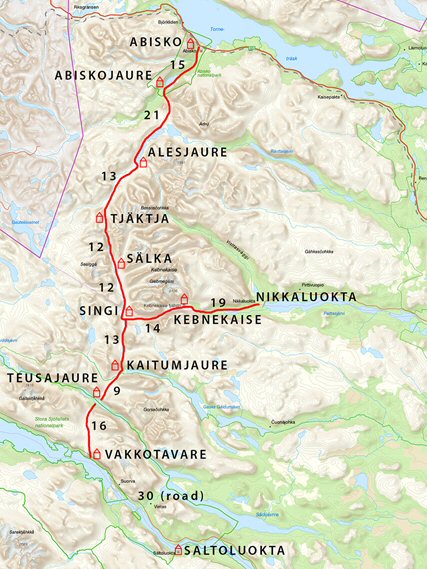
The Kungsleden ('King's Trail') is a long-distance path in north Sweden, 100 miles inside the Arctic Circle. I planned to walk the northern section from Abisko to Nikkaluokta, covering 108km (67 miles) and taking a leisurely 8 days. This included a day to scale Kebnekaise; the tallest mountain in Sweden at 2100m. (Ben Nevis is 1300m!) We were walking with full back-packs – tents, stove and food. It is normal to have snow fall here in summer, so clothing for all weathers.
It was a friend I worked with, Per, who suggested this trail. He has US/Swedish parents and grew-up in Sweden, so is bilingual. He did his National Service in this area, including taking out recruits in winter. A very useful guy to do the trip with !
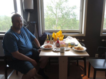
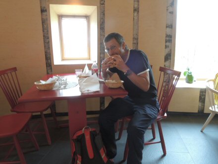
Fri 20 Jul – Flew Bristol-Amsterdam-Stockholm, then on to Kiruna, arriving at 4:30pm. 29 degs C, sun and scenery on a huge scale – birch forest, mountains and a lot of massive lakes. The whole town of Kiruna is being dismantled and relocated 3km away, due to under-mining by the gigantic iron mine, the spoil heap for which dominates the skyline. I met up with Per and we stocked up with provisions at the camping shops, supermarket and Government shop (Systembolaget), which is the only place in Sweden you can buy beer over 3.5% (watered down versions of beers are sold in other shops, e.g. <3.5% Old Speckled Hen instead of 5%)! Stayed at stf malmfältens folkhögskola (‘stf’ is equivalent to Youth Hostel and I got STF membership costing 295 SEK (Swedish Krona) (£24), saving 100 SEK (£8) camping at each station and giving access to station kitchens/showers).
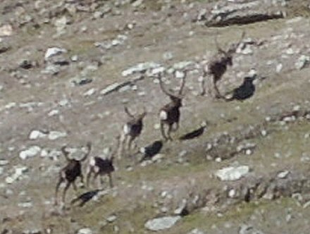
Sat 21 Jul –Went to station to catch train to start of trail at Abisko, but it was late with indefinite time of appearing, which is normal here. So Per and I used the time to set up the cooker for the first time, but as we were doing this, a guy was asking everyone waiting for the train if they wanted a lift to Abisko – we were last to be asked but snapped up the offer. He worked in the Abisko Tourist Station and was on a trip to get cans of beer. It is 90km and took over an hour, so we had a good chat (spoke excellent English, like everyone I met) and listened to music. 6 Reindeer were stood in the road at one point, and we inched past them – I could have touched them, so close. (Little did I know that we would only see them at one other place all trip.)
Abisko is a beautiful location next to a huge lake, surrounded by mountains, and with a large river nearby. North Sweden is covered in birch forest and permafrost, but this was the hottest July ever in Sweden, since records began over 260 years ago. The average temperature across the entire country was 3-4C hotter than usual.
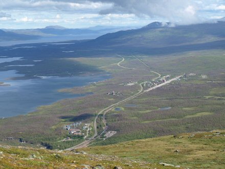
(The lake at Abisko is Torneträsk, area 130 sq mi – Sweden’s 6th largest lake, but to give an idea of how ‘lakey’ Sweden is, Windermere is England’s largest lake at less than 6 sq mi !)
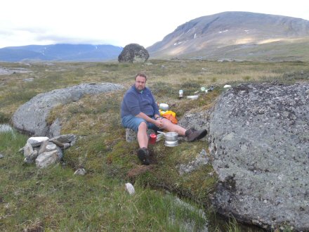
Per and I had our first meal that we cooked – pasta and sauce, with cheese, cooked in the stf kitchen.
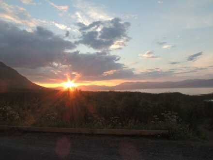
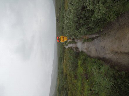
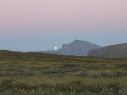
The above photo was taken at 10:50pm. There is daylight for 24 hours here at this time of year, which takes some getting used to.
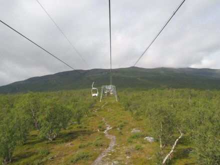
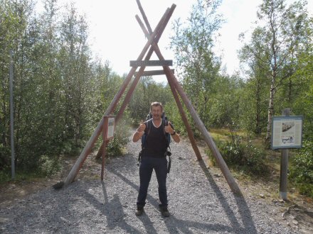
Sun 22 Jul – Got up early and went for a walk to a hide at Bird Hill (‘Fagerkullen’. Then got the ski-lift up the 1000m high mountain at the Tourist Station. Saw 3 bird species never seen before: Rough-legged Buzzard from hide at Bird Hill, and up the mountain, Long-tailed Skuas nesting and they alerted me to a Gyrfalcon flying over. (A write-up of all the wildlife seen on the trip is here - http://www.opsbirding.co.uk/Lapland.htm.)
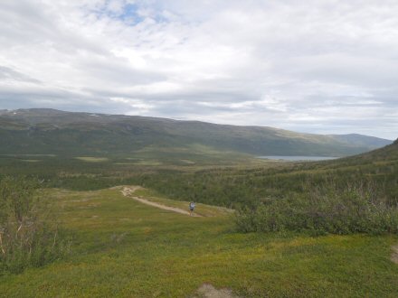
Mon 23 Jul, Walk Day 1 – Plan = Abisko -> Abiskojaure. 15 km (9.6mi), 3-4 hrs, +120 m elevation, Easy
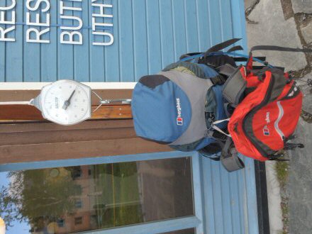
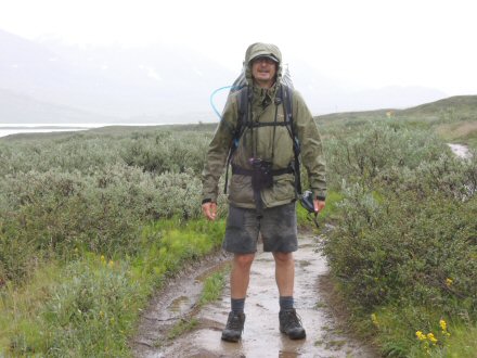
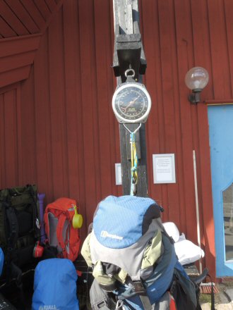
It is traditional to weigh your packs at start and finish of the trail. Mine was 17.5kg (Per’s was c25kg). But he is quite a bit bigger than me . . .
We left Abisko at 11:50am going through the Abisko National Park, which is beautiful. The path follows a glacial outflow river through birch woods. No mobile connection for next 6 days, until we get to Kebnekaise. And very little beer, . . . or food, as it turned out !

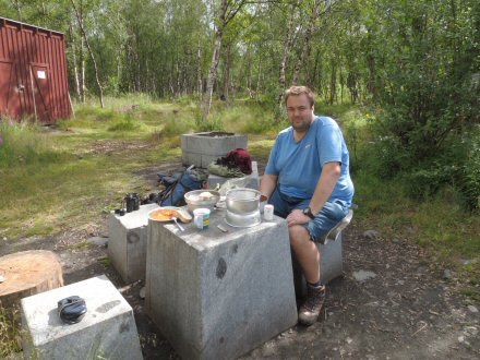
Our first meal on the trail (ravioli and the luxury of bread at the start). And this photo shows Per’s excellent Trangia cooker, which we relied on. After lunch, Per had the idea that I should teach him all the rules of cricket to give us something to pass away the hours/days.
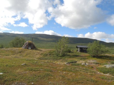
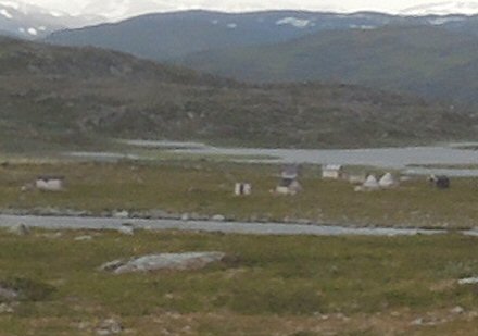
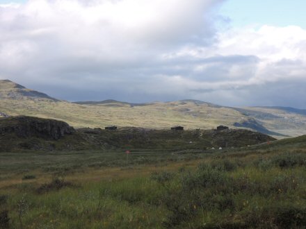
It hadn’t occurred to me that there would be Sami villages and reindeer herders along the trail. This was the first one we saw. The traditional hut on left is only being used for storage, the new hut for staying in.
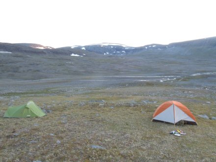
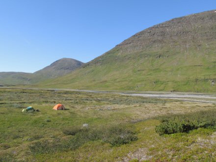
We walked 18km (11.2mi) on first day, 3km further than planned. We were going to stop at Abiskojaure stf, but Per knew of a Reindeer station (‘Rengarde’) a little further on. I went over the bridge to the stf station just to have a look and see if anything useful in camp shop, but it was busy. When we got to the Reindeer station that was a bit busy also (‘busy’ here meaning about 10 tents in the woods). It had a toilet, but no other facilities (but you can get water from the river). We went over a river-bridge to a fantastic place to camp, with superb view across the valley.
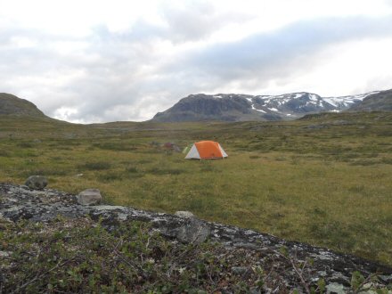
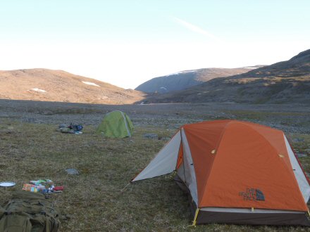
You can see the tents in this photo – Per’s orange one is at back on the right, and my green one on left.
We built a fire, and I set up the small twigs and paper to light it – impressed Per that it only took one match ! But he wasn’t so impressed with me trying to burn the first Moose droppings I found ! Per was also concerned that our fire was not the regulation 150m from our tents ! In the photo below, the small plastic bag on right is Per’s prized dry matches, for starting fires and the cooker, and on left is my prized possession of dry tea bags ! I insisted we had a cup every stop. Man cannot walk on no tea.
Tue 24 Jul, Walk Day 2 – Plan = Abiscojaure -> Alesjaure, 21km (13mi),7-9hrs, +350m elevation, Difficult
Left camp at 11:20am and the path immediately started to go up hill. Per started to go slow, down to 1km/hr. I saw my first Reindeer poo !
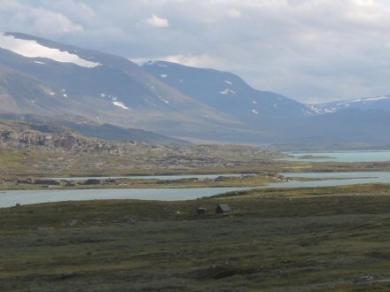
We walked past a Sami village and followed the shore of a lake for 2 days. (It’s a puddle compared to the one at Abisko !)
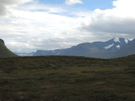
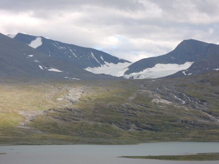
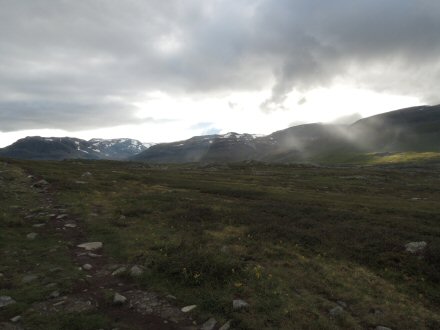
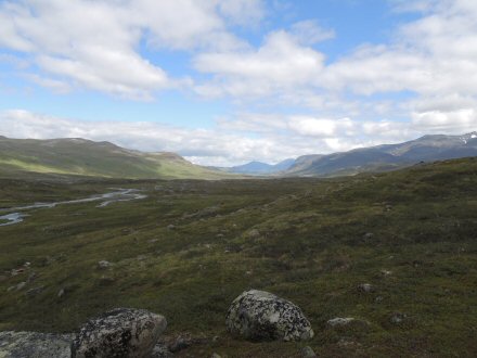
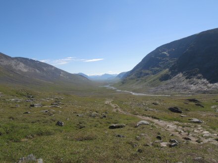
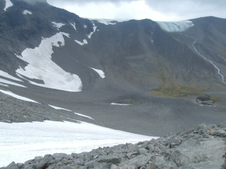
The scale of the landscape is just on a completely different level to anything in the UK. The valleys are glacial, same as in Scotland (with typical U-shaped sides, as in the photo below) but the valley shown here is about 3km across, and about 10km long. Per saw our first Lemming.
We only managed 10km walking in the day, due to the uphill, so didn’t make it to the station at Alesjaure. We camped at Radunjarga – a pretty awesome spot by a lake filled from the outflow stream of a glacier (‘Godu’) just up the mountain. (Roaring of stream continuous.) Today was the first time I had ever seen a glacier ! We cooked Chilli & rice.
There are two wooden huts here: one with a wood stove (for use in winter) and another small one with a long-drop toilet.
Wed 25 Jul, Walk Day 3 – Plan = Alesjaure – Tjaktja, 13km (8mi), 3-4hrs, +200m ascent, Moderate
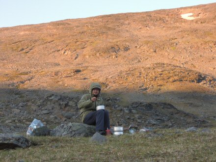
We left camp at 11:10am after a breakfast of Dry Roast Peanuts and tea. After 2 days, we had exhausted the provisions we carried from the start. On the trip, it was a constant battle between having enough to eat and the weight that this added to the back-packs. We erred on the light/calorific-lacking approach.
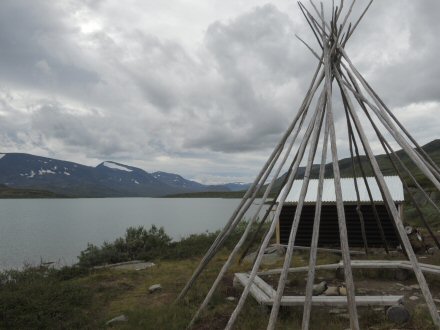
The Sami run a boat from near where we camped to the end of the lake, but that’s for whimps ! The photo below is where the boat goes from, with the frame for a Sami tent.
If we had got the boat, we would have missed our first walk in the rain. I say ‘rain’ but for the first hour, Per insisted that “this isn’t rain, yet”. When it got horizontal it got the official nod. The photos below were after the RAIN. I was in stealth kit, Per wanted to be found when the helicopter came !
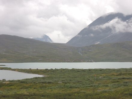
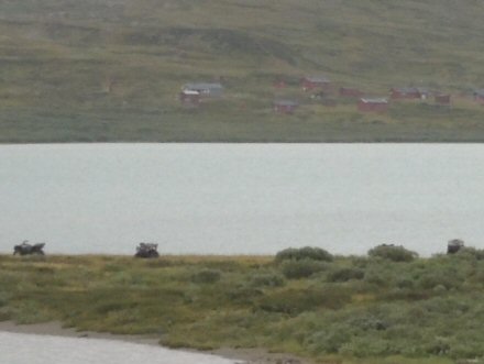
The mountains look more menacing in the rain clouds. The photo on the right below is zoomed-in, to show a Sami village on the far bank of the lake and their quad-bikes left on the near side, reached by boat.
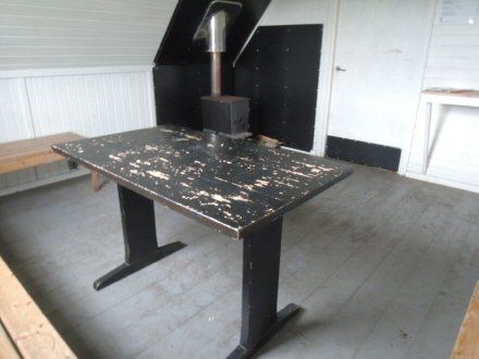
We got to Alesjaure at 2pm (half a day later than planned) and it was packed with walkers and their soaking wet rucksacks and kit. Like all the stations, boots left by the door/outside (about 30 pairs), but it is a nice big wooden station with good view, and tea/coffee, which Per advised was traditionally free-refill in Sweden ! We re-stocked supplies from the shop – which is twice the normal Swedish price (which itself is twice the price of UK). About £5 for a tin of food. Left the station at 4pm after rain stopped.
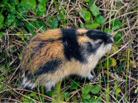
The photo below shows the state of the majority of the trail – easy to follow, but every foot-step had to be carefully selected to avoid rocks, which is wearing. Some sections of the path, where there are bogs, have board-walks, and running under these I saw my first 2 Lemmings – lovely looking little things.
I finished teaching Per the rules of cricket today, after 3 days. (PS. I forgot to mention that for lbw the ball has to pitch (i.e. bounce) in-line with the stumps as well as being on target to hit the stumps.) In return Per taught me about the political history of Sweden – boy did I get the rough end of the deal !
We camped at 8pm, after fording a river. (Three 18 year old girls camped the other side of the river – more about them later.) We had walked 13km, which is exactly the distance planned for today, but that still left us about half a day back.
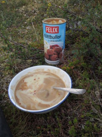
We ate meatballs with mashed potato and chilli flakes. It may not look appetising, but we hadn’t eaten all day (10 hours), and it tasted gorgeous !
Thur 26 Jul, Walk Day 4 – Plan = Tjaktja - Salka, 12km (7.4mi), 4-5hrs, +150m ascent, -300m descent, Difficult
Left camp at 11:55am. The photo below is looking back down the valley we have been walking up for the last 2 days – the mountain in the very centre of the photo is ‘Giron’, and we had camped right by it on our first night. So it is 23km away ! That gives an idea of the sheer scale of the landscape here – not captured in photos.
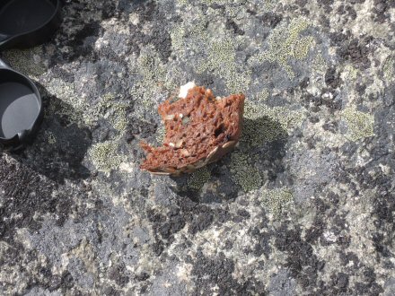
The best moment of the day came when I found a paper package with a pumpernickel and cheese sandwich, chocolate, coffee sache and Earl Grey teabag in it. That was the nicest sandwich I have ever eaten !
The inset in the photo below shows the Renaktastuga (roughly translated as ‘Reindeer watching hut’), which was occupied by some Sami, as their quad bikes were outside.
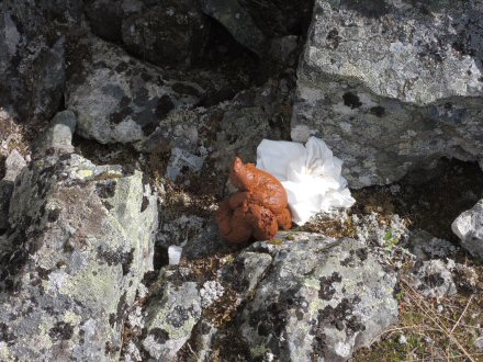
Up to this point I had managed to find long-drop toilets or station huts to go to toilet, but this was my first wild toilet experience, and it was such a work of art I had to take a photo ! Perfect.
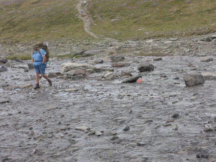
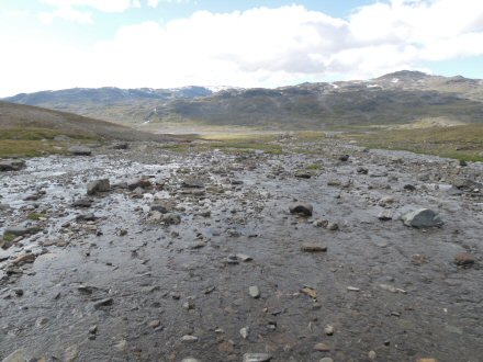
There are a lot of rivers to ford across in this region. They need a bit of concentration to avoid a bootful of water. The one below was very wide, but shallow. Per skipped across it like a ballet-dancer!
We got to Tjaktja (said “chak-cha”) station (where we originally planned to get to last night) at about 5pm and I went on ahead and crossed the suspension footbridge, to get supplies. There is no shop at this station, but in all the stations there is a kitchen for use of campers (who pay a small fee for it), and people leave any food they do not want in them. I found some dried Tortellini, a can of tomato sauce, Cinnamon and some Squash that I used to make a concentrated sweet solution for my water-bottle.
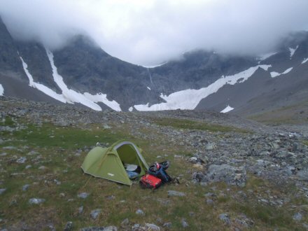
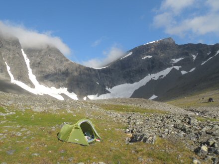
We camped just before the Tjaktja Pass station hut, which is the highest point on the trail, at 1140m. (The small hut can just be seen in the dip in the saddle in the middle of the photo on left, below.) So up until now we had been climbing continuously from sea-level at start. We had walked 11km in the day, just 1km short of planned, but still 11km behind from 2nd day.
This is an incredibly remote and desolate spot, and was quite windy and cold. We had trouble finding a spot to pitch the tents. (Per did insist on finding “luxury accommodation”; flat, level, stone-free and with a substantial layer of growth to lie on!) But all the looking had a bonus – I found a nice aluminium water bottle. We didn’t eat until 10pm – mushroom risotto and tuna, with a pinch of cinnamon. We sat and watched the last of the evening sunshine creep up the side of the mountain behind me. I did ask Per how far the nearest hospital was. The answer was about 270km. But that wasn’t the problem. The problem is that the only way out was by helicopter, and the Army/Police own the helicopters and are reluctant to have them used for ‘minor’ injuries, such as a broken leg ! Realistically it would take a minimum of 2 days to get to hospital.
The view across the river valley (below) was an amazing mass of scree slopes, leading up to the mountain in the centre of the photo, at 1462m.
Fri 27 Jul, Walk Day 5 – Original Plan = Salka - Singi, 12km (7.4mi), 3-4hrs, +50m ascent, -150m descent, Easy
In the middle of the night, I saw 5 Reindeer on the high skyline. Despite Per’s happy face in the morning, he wouldn’t leave his tent ! I left camp at 11:20am and went to wait for him at the station hut. Per left camp an hour later and took an hour to walk the 0.5km. While I was waiting, 6 Reindeer ran across the slopes.
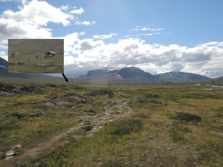
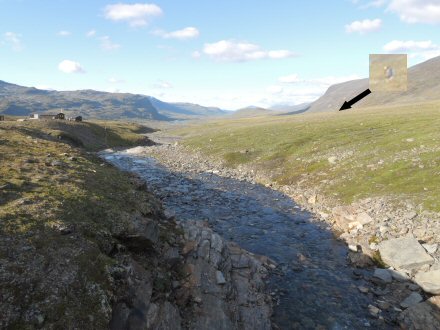
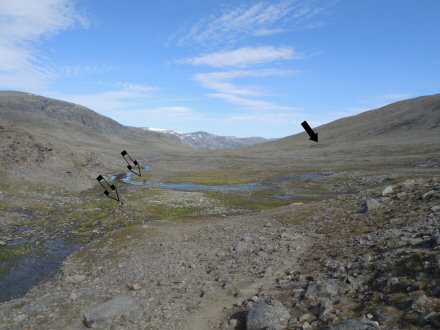
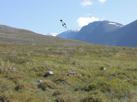
The photo below is looking from Tjaktja Pass hut, back to where we camped (black arrow), and has two pairs of people walking in foreground (transparent arrows) to give an idea of scale.
Per had a right go at me when he got to the hut – not because I had left him, but because I had left my precious teabags and powdered milk on the ground when I had packed up camp – “a soldier never leaves camp before checking the ground”. This disaster would not have been catastrophic, as I had an emergency stash of teabags on me !
The photo below shows the view forward from Tjaktja Pass, along a valley we would follow for the next 2 days. We would now be going downhill, but Per had really run out of energy and it took an hour to do the next 1km. We were heading towards Salka Station, which is the nicest on the trail, so we decided that I would go ahead and spend some time there while Per took it easy walking. The time was 2:20pm, and it was 8km to Salka. So we had a bet; I said that I would get to Salka at 4:30pm, and that Per would get there at 8pm. He reckoned he would make it at 5:30pm.
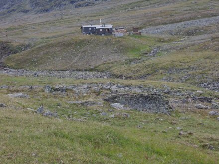
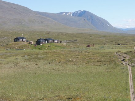
I didn’t quite make the time I estimated, as I arrived at 4:55pm. The photo below is of Salka Station, taken as I approached it. The helicopter is there flying people in for a day trip. On bottom-right is a wooden walk-way which are on the boggy areas of the trail (although many are in need of repair).
I went in the small shop and spent £70 on provisions (enough for about 1.5 days for us), including 2 cans of Swedish 3.5% beer at £7 a can! I found a nice sunny spot and sat drinking them – superb ! A Swedish guy with a big bushy beard had the same idea and we got chatting. (He spoke perfect English, like everyone else on the trail, wherever they were from. It really is the universal language. In fact some Swedes told me that they were so used to using English that they had been talking to some other Swedes in English for half an hour before they all realised!) He worked in a Camping shop in Stockholm, and had walked all week across the mountains off the trails. He was ‘testing’ some of the shop’s kit which he had borrowed for free. I asked him about the Sauna at Salka, and in particular, do you go naked in them ? He said that in Stockholm he and his friends wear underwear in the Saunas, but here we are in red-neck country and the rules for everything was different and they go naked. Also, the times of the Sauna were: 6pm women, 7pm men, 8pm mixed. So at about 7:15pm I turned up at the wooden Sauna shack knowing nothing of what you do. There is an outer area where you strip off and then some buckets of cold water in a wet room, and a glass door to the heated Sauna. There was enough room for 8 blokes on 2 rows of wooden benches; a lower bench that was full with 4 naked blokes and an upper (hotter) bench with 3 naked blokes on it. So, I squeezed, naked, through the first bench to sit thigh-to-thigh on the upper. I was missing a towel to sit on – but, I didn’t own a towel. Being naked really is an ice-breaker, it is difficult to be up-tight. I then noticed that a young lad did have swim-shorts on, and he looked most nervous out of us. He was in there with his dad and I had had a bit of a chat with them on the trail before. When I announced I was a Sauna virgin, the old man said that I should aim to go for 15 minutes, and the rest sniggered a bit. After about 5 minutes of good chatting, all the others got out, leaving me and one guy in there. He was a nice chap and we chatted. It was mighty hot on the top shelf (there was a thermometer, but I forget the temp). After another couple of minutes he said he was going to jump in the river (which was a glacial stream), so I join him. We walked about 20 yards outside the hut, butt-naked, and jumped in the freezing cold, but really refreshing, water. Then back to the sauna – where we used the cold water buckets to clean feet, before another couple of minutes in the heat. Apparently, the Salka Sauna is one of only a few left that is heated by wood, not coal, so has a lovely smell to it. A brilliant experience. My bushy-bearded friend went to the mixed session – maybe next time. . .
In the 2 hours between arriving and the sauna, the three 18-year old girls (an Italian and 2 Germans) who had camped near us arrived at Salka, looking a bit ragged. I asked them if they were alright and they told me how they had eaten Kidney Beans the night before, only they just soaked them and not cooked them (!) and all had bad stomachs. I made them all a cup of tea – the cure for everything.
After the sauna, I went round
everyone who was in the camp (about 20 people) and asked each one if they had
seen Per (not easy to miss !), and some had seen him
along the Trail. And at 8:45pm he wanders into camp looking a bit tired, and
gets greeted by absolutely everyone he meets as if he is an old friend ! After a bit of a rest Per
says we should push-on and see where we can get to. So we keep walking until
after 10pm when the sun goes below the mountains. There are no other people on
the trail at this time of night, and I spot the best birds of the trip – a Temminck’s Stint (a small wading bird which only breeds in
this part of Norway and Sweden), and it has a family of tiny balls of fluff
running along behind it through the grass. (See my wildlife summary for a photo
and video - http://www.opsbirding.co.uk/Lapland.htm.)
Per's first question after every new bird we saw was, "can you eat it ?"
Consequently, his favourite birds were Golden Plover and Ptarmigan !
Strangely the Swedish army advise in an emergency, to only eat birds if no other animals/plants are available - not sure why.
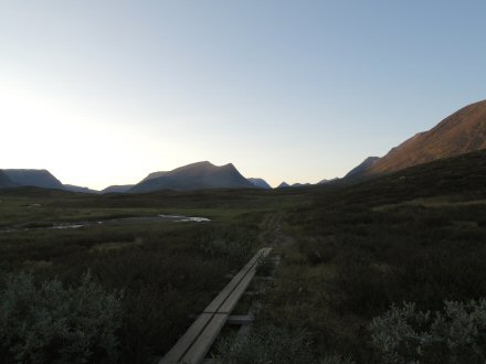
The 2nd photo below was taken after midnight.
We walk 2.5km from Salka, and have done 12km by the end of the day, but are now almost a full day behind plan. Looking back at the write-up, this was a pretty full day, but nothing compared to what was to come tomorrow.
Sat 28 Jul, Walk Day 6 – Original Plan = Singi - Kebnekaise, 14km (8.7mi), 4-6hrs, +200m ascent, -230m descent, Moderate
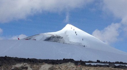
Per hatches a plan to make up the day we have lost. It’s as cunning, as it is suicidal . . . for me. The original plan was to get to Kebnekaise station today, and then for me (alone) to ascend Sweden’s highest mountain – Kebnekaise the day after. Kebnekaise mountain is 2100m high, and requires a 25km (15.5mi) walk, taking 8-12hrs, with a +1444m ascent; for comparison, Ben Nevis is only 1300m high, the walk is 6.8km (4.3mi), advised time is 5-7 hrs, and ascent is +1325m. Oh, and the summit of Kebnekaise is a cone-glacier (photo below).
Per knows of a short-cut directly
to Kebnekaise mountain (see below - zoom the page
to 200% to see details on map). So rather than follow the trail (orange)
south to Singi, and then East to Kebnekaise station
and then go up and down the mountain next day, I can go straight up and down
the mountain today and get to Kebnekaise station. Per wasn’t intending to go up
the mountain, anyway, so he will take 2 days to go along the trail, and meet me
at the station. 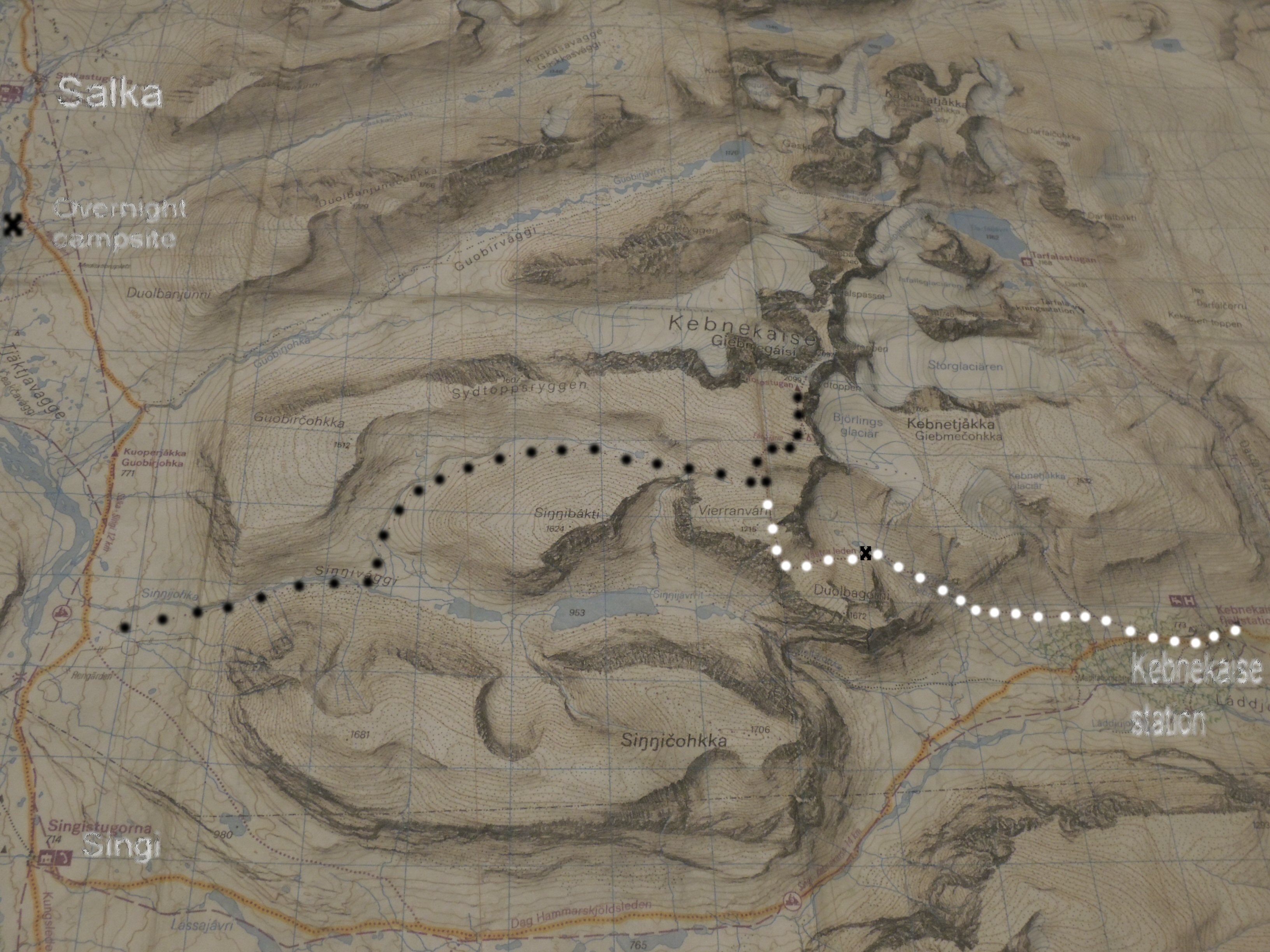
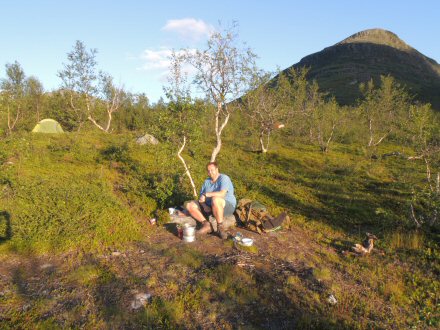
I left camp at 11:25am. Photo below shows where we camped.
From the main trail, heading south I got my first view of the peak of Kebnekaise. A long way off, and a long way up.
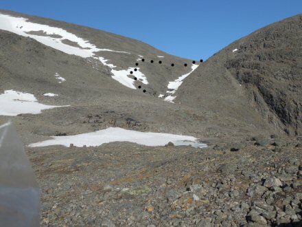
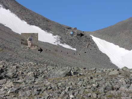
I made steady progress, finding the correct valley to turn left at(!). The path then started to go uphill, but at a steady incline, as expected. But I soon came across the unexpected problem that would be with me all day – boulder fields. (Zoom in on the map and all the black dotted areas are boulders.) The boulders vary from football-sized to that of a chest-of-drawers. And they lie layer upon layer, with the real problem being that some are ‘rockers’, but you have no idea which one out of 100 it will be. After 7km of walking boulder-to-boulder, I inevitably found a rocker that put me off balance and made me fall; luckily I managed to put my arm down (bit of a graze) and stopped falling over completely, which could have really been a problem, but I jar and twist my knee which hurt and is still causing me problems now. But this was no time for feeling sorry for myself, just had to get up and keep going. I only saw 3 people in the 13km from when I left the main trail to when I got to the main route going up Kebnekaise; a German who was going same way as me and I was hoping I could walk with him but he was camping in the valley, and 2 Swedish people coming the other way. In a place like this, alone, quiet, reliant on yourself, you get a sense that you are the only person left on the planet. This Youtube video captures some of what I mean . . . Walk to Kebnekaise - 360 degree view of valley. What an awesome place ! You can also get a sense of the tricky terrain.
A few km’s before joining the main path up the mountain, I
got this amazing view looking south between Sinnibakti
on right (1624m) and Vierranvarn on left (1716m –
over the top of which my route back down goes !), across to Sinnicohkka
(1706m). The lake is 1.5km away and 500m down. I stopped for lunch here at 4pm.
The other photo below is from same place, but I have turned
90 degrees to my left, and it shows the route I take up and across a snow
field.
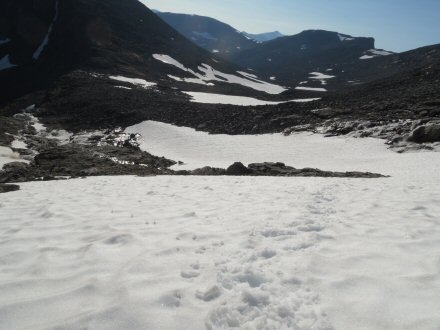
With full back-pack, going
steadily up hill, I was only doing 1.5 miles per hour. The photo below is from the snow field, looking back. What it doesn’t
show is that the slope I am standing on is at 45 degrees, and any slip would
result in a slide down to the rocks below.
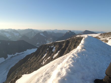
It took until 7:10pm to get to the main path, which went left, up the mountain. As I would be coming back down this way, I dumped the heavy rucksack behind a large rock and just took what I needed, and valuables, in a small rucksack. It was so nice to be walking without all the weight, although the steepness of the path increased, as this was the main climb up Kebnekaise. I had a nice chat with an old couple from Peru, of all places, coming down. They told me that the view was worth it. It took an hour to get to the base of the summit. (Below image copied from Google, shows the unique cone-glacier at the summit, and people climbing it. The ice was not quite as thick when I was there. But the profile and extent of the ice cone was the same.)
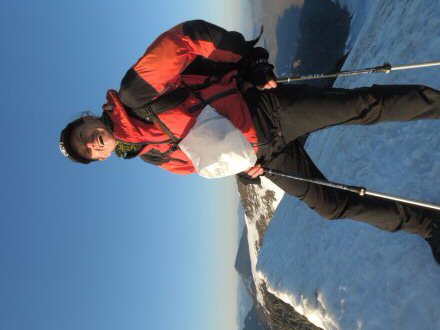
My plan was to blag some crampons from someone, as it is not normally possible to get to the top without them. But I was so late getting there, that no-one else was around, so I just had boots, coat and gloves. It wasn’t too bad getting up the first slope, which is very steep, but had people’s foot marks to walk up. It then flattens out for a section, and then I got to the actual cone, which is glacial ice – very hard and very slippery. I did what I usually do in face of adversity – I just ran at it full-pelt ! My momentum and scrambling on all-fours got me about halfway up. Then the ice gets even harder and slippier. I could only edge up by digging small indentations into the ice with my boots. A couple of times I slid back down again and had to find a better route. I got to within 10 metres of the top, but exhaustion was setting in. So close, but I couldn’t see a way to do it. Then my saviour arrived, in the form of a Czech guy with crampons and ski-poles coming up to where I was – he spoke English and made little steps in the ice all the way to the top for me. What a nice guy. (Got to top at 8:45pm.) So there is him and me on the top of the world, with what looks like the whole of Sweden and Norway below us. The view was staggering, but I didn’t have time to take it in, as I was standing on the tip of an ice cone, with certain death on 3 sides if I slipped ! My mate had crampons and poles to keep him there – I had nothing. I literally took the three photos below, turned, and slid all the way back down the way I had come, on my bum - what a ride!!
My Czech friend and the view towards the North peak of Kebnekaise. When the ice melts on the South Peak, the rocky North one becomes the highest point. This happened about a week after I was there.
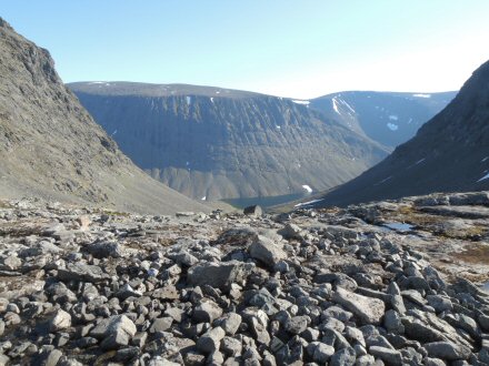
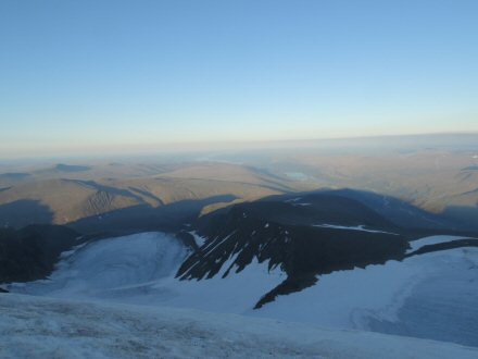
The view to SE (below) - you can see the shadow of Kebnekaise, and two glaciers (Bjoerlings on the right). The valley with river/lakes, far below on right, is where the Kebnekaise station is – my destination today.
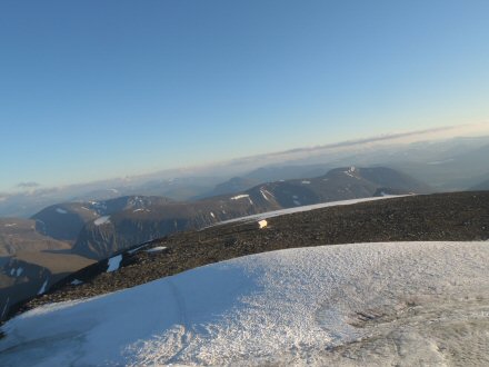
After sliding down the cone, I took the photo below from the plateau on the glacier, looking back the way I had come – the valley far below on right with water in was where I had started the day. (The white square box in the middle of the photo is the new mountain hut, which is a substantial building, but looks small from up here.)
It took me another hour to get back down to my back-pack. (Same time going down as it was going up !) At 10pm the summit of Kebnekaise was in thick cloud, so I was very lucky to get such an amazing view.
The route to Kebnekaise Mountain
Station was c7km, but it involves an immediate ascent of c800m over a 1700m
high peak (Vierranvarn), followed by a descent of
c1km on very rocky terrain. After the day’s walking I had had, the ascent was a
killer with back-pack on again. And now the weather was closing in and light
fading. I was very happy to catch up 3 pairs of people, including the
Peruvians, to confirm I was on right path. The long descent was worse than the
ascent – it was a scramble down a very steep rock field, and my knees
complained at every single step. I decided that I was going to pitch my tent on
the very first available bit of flatish land I came
to, as I had been going now for 12 hours, and was tired, knackered, hungry and
worse of all – I hadn’t had a cup of tea all day !
The first photo below shows the boulders on the descent (you can just make out a red dot on a rock on the right, which marks the path). And the first patch of green is where my tent went. That is one remote campsite. (Yet, someone else came along and camped in the same valley.) On the map above, I camped at the small black cross on the white dotted path. Total distance covered in the day = 22km (13.7mi).
I got some water from the melt-water stream in the valley and made a well-earned meal. Unfortunately, Per had our only cooker. So for starters it was cold tinned mackerel mushed up with bits of pumpernickel bread. Followed by a ready-made pasta in cheese sauce meal – just add water. But not just cold water – it was horrible and I only ate half of it. (The rest, I put in the ruck-sack for breakfast. But it leaked out and covered everything in a smelly cheese sauce – can still smell it now.)
And THAT is how you use a Saturday to its fullest ! I was buzzing from the most epic day, but boy did I sleep well.
The view that greeted me in the morning, which was beautiful and sunny.
This is the difficult rocky descent I came down last night. Doesn’t look so bad on the face of it, until you see the size of the two people in the photo – enlarged so you can actually see them. Zoom to 300% to get an idea of size, steepness and difficulty of the slope.
Sun 29 Jul, Walk Day 7 – Original Plan = Kebnekaise ascent, 25km (15.5mi), 8-12hrs, 1444m ascent and descent
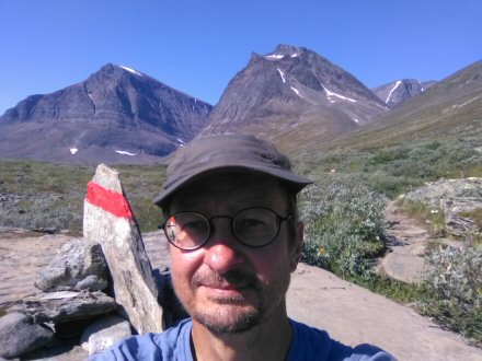
I left camp at 10am and walked to Kebnekaise Station in 2 hours, with legs aching from the exertions yesterday. Just outside the station I got a phone signal – the first for 6 days, since we started the walk. I took this selfie looking back up to the mountains I had just camped in. Then Whatsapp’d Per, so he’d get the message when he arrived and then sent a message to my family to let them know I was alive.
On reaching the station, I went straight to the restaurant and had a buffet of Pork, spuds and salad. Then went to the bar and celebrated the return to civilisation with 3 pints of draught beer (Ship Full of IPA 5.8%, Sleepy Bulldog 4.8% wheatbeer & Tail of a Whale 5%) at £8:50 a pint, while waiting for Per.
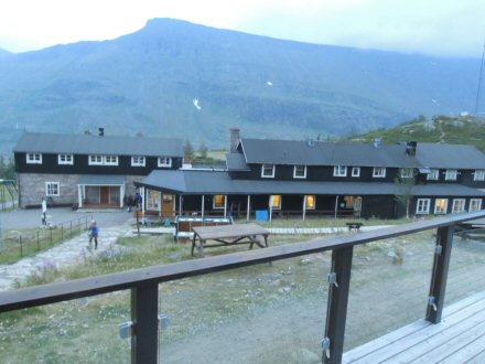
He showed up in the kitchen in the evening, having had blisters and “nearly gave up” on the walk. (He hadn’t put his phone on as it needed charging and he had “other priorities”.) We pitched our tents near the station - I was very tired.
Mon 30 Jul, Walk Day 8 – Original Plan = Kebnekaise - Nikkaluokta, 19km (11.8mi), 5-7hrs, -250m descent, Moderate
We left camp at 8:45am, after sorting Per’s blisters out with patches. I was still aching after Saturday, and it was nice to be walking on the flat again. We got to a place where a boat cuts 4km out of the walk, but boats are for whimps ! It was nice to get to a famous restaurant that sells Reindeer burgers, Coke and I had English tea with REAL milk – luxury !
We got to the end of the trail at 3pm.
As tradition dictates, we weighed our backpacks – mine was 14kg, 3.5kg lighter than at start, due to using provisions. (Although we did joke that mine could be first ever to be heavier at end, as I had added a metal water bottle and a Kebnekaise station pint glass!)
Wow ! What an adventure !
Total distance = 110km (68mi)
We had a 2 hour wait for the bus back to Kiruna and civilisation. Spent it talking to the other walkers waiting: the German in the sauna, a Swedish guy walking with his two 14/15 year old girls, and two Swedish hippies (one called Alex). We covered all topics on the Trivia board, and then some: Sport, History, Politics, Food. I tried to explain what a faggot was ! The bus had USB’s for charging phones, free wifi and air-con – it’s a different world over there !
PS. The £8.50 for a pint was beaten by £14 paid for a craft beer pint in Narvic, Norway !